It started raining heavily from Wednesday, which kind of made me a bit happier. Not that I wasnt going to venture out this weekend. But then a prospect of good outing is always pleasing. If not then there is a weird fun in pushing yourselves to limits. Either case, headcount wise there was addition in form of M and one new found fan on the Peth trek last weekend.
To start with the proposal was to go to infamous Mangad. Last year some ill informed locals around had completely denied that this place existed and we had to hike Kurdugad. It was agreed upon that we all meet at Chandni Chouk at 7.00 with our respective bikes, though on Saturday morning we set off in M's Sail towards Borwadi at 8.00 AM [ again ].
To reach Mangad one has to :
Travel to Tamhini via Paud from Chandni Chouk. Get down the Tamhini Ghats.
Take the left to Mangaon/Nizampur from Vile. From here Nizampur is 15Km.
Take a left in Nizampur towards Pachad - Raigad Ropeway and keep asking for Borwadi.
Borwadi is about 4kms from Nizampur. Park your vehicles in Borwadi, walk to Masadwadi-Mashidwadi. This is the starting point for the climb.
We parked the car at Borwadi, asked the locals about the best route to climb etc and moved towards Masadwadi-Mashidwadi. Yes you are right, the name is derived from Mashid in Marathi meaning Mosque. The fort was apparently constructed by Muslim rulers and there is a fair amount of population around here to prove that too. There is a ancient Shiva temple here which was turned into ruins by the Muslims. Watch out while climbing the rock cut steps. If you are weak"er" at heart this is not for you.
The Maharashtra State Gazetteer says that this is the smallest of the three in the region and is true. We got up on top non-stop within 20 odd minutes. There is a temple midway. There are traces of fortification. Some water tanks, an empty cave and a
Dargah. From the top one can spot the main range of Sahyadris which stands much taller than the fort, Kumbha pass and the villages below. We got down at about 4.00 PM amongst heavy rains and decided to hit Tamhini.
The waterfall at the base of Tamhini had soured in size by the time we reached there. We decided to climb up for some raw fun/thrill. After spending an hour and realizing that it had worsened even more, even for making us difficult to get down to the car, we headed back. Enjoying our drive back amongst a series of beautiful waterfalls.
Find the complete imagestation album
here.
 No weekend breaks - A farmer slogging out early morning in Mulshi.
 Where the road goes round Plus valley - The Bhira Hydroelectric pipes in Tamhini.
 Main range of Sahyadris to the East of Mangad.
 A lush Paddy field near Borwadi.
 Waterfalls in Tamhini. These thundered the way back.
 Water tanks and the farms below - Mangad.
 The ruins of fortification
 Parsha - [ Parshuram ] the guide at Entrance. Parsha is a good man.
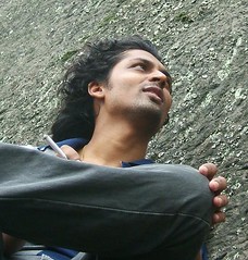
 The climb