Sunday, August 07, 2005
Hadsar
Our Ratangad one day adventure plan did not work out well. The transport guy turned up late. So we needed change of plans. So we decided to trek Hadsar. It was a team of seven. My Paxonet buddies and me.
Way to reach Hadsar is to reach Junnar via Narayangaon from Pune and then take the road to Manikdoh [ A right turn followed by an immediate left]. Hadsar is about 16 Kms from Junnar. There is a route which starts from Hadsar itself and is the shortest one. We took this route for climb. It hardly takes an hour to get up from this route. Although the final section is a bit tricky. The other route from where we got down has steps and is a bit lengthy one, as it goes round the left end of the fort.
You have a very strong wind on the top which on this day seemed to beat gravity when it came to the waterfalls. I had never seen the water being thrown back up from the valley so beautifully ever. There is a Shiv-Mandir on the top and couple of water tanks. There are couple of caves to the left side as you reach the top. One can see the Manikdoh dam waters from the top and fort of Chavand on the other side of the dam. You can also spot Jeevdhan from Hadsar to your right across the backwaters of Manikdoh.
Epilogue : A nice fun one dayer. I managed to put some google juice here so the good news is I am listed in google which I found as I write this. I need to watermark the pictures henceforth I guess.
More images can be found here
Way to reach Hadsar is to reach Junnar via Narayangaon from Pune and then take the road to Manikdoh [ A right turn followed by an immediate left]. Hadsar is about 16 Kms from Junnar. There is a route which starts from Hadsar itself and is the shortest one. We took this route for climb. It hardly takes an hour to get up from this route. Although the final section is a bit tricky. The other route from where we got down has steps and is a bit lengthy one, as it goes round the left end of the fort.
You have a very strong wind on the top which on this day seemed to beat gravity when it came to the waterfalls. I had never seen the water being thrown back up from the valley so beautifully ever. There is a Shiv-Mandir on the top and couple of water tanks. There are couple of caves to the left side as you reach the top. One can see the Manikdoh dam waters from the top and fort of Chavand on the other side of the dam. You can also spot Jeevdhan from Hadsar to your right across the backwaters of Manikdoh.
Epilogue : A nice fun one dayer. I managed to put some google juice here so the good news is I am listed in google which I found as I write this. I need to watermark the pictures henceforth I guess.
More images can be found here
Thursday, August 04, 2005
Monday, August 01, 2005
Rajgad
Couldn't cook any plan till friday. AB was stuck in Mumbai due to heavy rains. Got a call late Friday night from PN. He said we were six, and we better decide someplace on Satara side. We thought about a trek to Vairatgad. We started late in the morning so a change of plans had us aiming for Rajgad.
We reached Gunjavane at about 11. If you want to take the Chor darwaja, you have to go to Gunjavane or else you can go to Vajeghar and climb by the Pali darwaja.
The water stream near Gunjavane had swollen and there was water flowing over the bridge. We manage to ride across on bikes. We started our climb with the company of two dogs. We trusted the dogs for the route and let them lead us. That turned out to be a mistake. After a walk of an hour or so we met the local Vijay Mallya who was transporting his brew to the base [ The Hatbhatti if you know this magic potion i.e. ]. He told us we were on the wrong road. So we headed back and Mr Mallya guided us to the correct road.
We made it to the top in another hour or so. It was raining heavily, we hadn't made food arrangements. To add to the problem we met an old chap who had lost
his cow on the fort and was searching for past two days. He needed something to eat. So whatever we had we gave 1/3rd of it to him. We went conservative.
We started getting down at about 4.30 from Chor darwaja. We had some Pohe and tea at the small joint at base and started our journey back. There was more water flowing now on the small bridge. Luckily we got some help from another group we met on the way back to get our bikes across.
But there was another surprise on the way back, another bridge on the way back was submerged. Wasnt worth risking lives in that roaring water barrier of about 150 mtr. To our luck we found an alternate road. Heavy rains meant not much of photography. Overall a nice cool one dayer. Came back to discover Ferrari was on pole.
We reached Gunjavane at about 11. If you want to take the Chor darwaja, you have to go to Gunjavane or else you can go to Vajeghar and climb by the Pali darwaja.
The water stream near Gunjavane had swollen and there was water flowing over the bridge. We manage to ride across on bikes. We started our climb with the company of two dogs. We trusted the dogs for the route and let them lead us. That turned out to be a mistake. After a walk of an hour or so we met the local Vijay Mallya who was transporting his brew to the base [ The Hatbhatti if you know this magic potion i.e. ]. He told us we were on the wrong road. So we headed back and Mr Mallya guided us to the correct road.
We made it to the top in another hour or so. It was raining heavily, we hadn't made food arrangements. To add to the problem we met an old chap who had lost
his cow on the fort and was searching for past two days. He needed something to eat. So whatever we had we gave 1/3rd of it to him. We went conservative.
We started getting down at about 4.30 from Chor darwaja. We had some Pohe and tea at the small joint at base and started our journey back. There was more water flowing now on the small bridge. Luckily we got some help from another group we met on the way back to get our bikes across.
But there was another surprise on the way back, another bridge on the way back was submerged. Wasnt worth risking lives in that roaring water barrier of about 150 mtr. To our luck we found an alternate road. Heavy rains meant not much of photography. Overall a nice cool one dayer. Came back to discover Ferrari was on pole.
Tuesday, July 26, 2005
Monday, July 25, 2005
Pandavgad
I managed to convince AB that Pandavgad isn't that far for a bike trek from Pune so he agreed to come along for this weekend. Unfortunately he called me up on Saturday night to tell me that he was unavailable. But I had company. Note that the company is an essential ingredient of a good trek. If there is lack of good rapport then it could be a torturing experience. Anyways so enough of this, we are here to go over the actual details.
We started a bit late for reasons I wouldn't want to explain and you would be bored to read. We reached the Nasarapur corner at about 7.35 am and had breakfast there. We took a right turn to Bhor, [12Kms from the turn]. From Bhor you can take a left to Wai [ 35Kms from there] via Ambade ghat.
So this road actually saves a lot of distance and the ghat is an interesting and scenic place. Although don't expect an expressway kind of road. It's like a typical monsoon Pune road at places.
On top of this ghat is a place called Mandhardev which has a temple of Mandhardevi. Due to one pious individual with us, we took a turn to this place from ghats [3.5Kms from here]. This ghat separates Pune and Satara districts. The Wai taluka on one side and Bhor on other. Mandhardev is most of the times in clouds and attracts lot of pilgrims on Navratri. In February 2005 there was a stampede which claimed 300 lives.
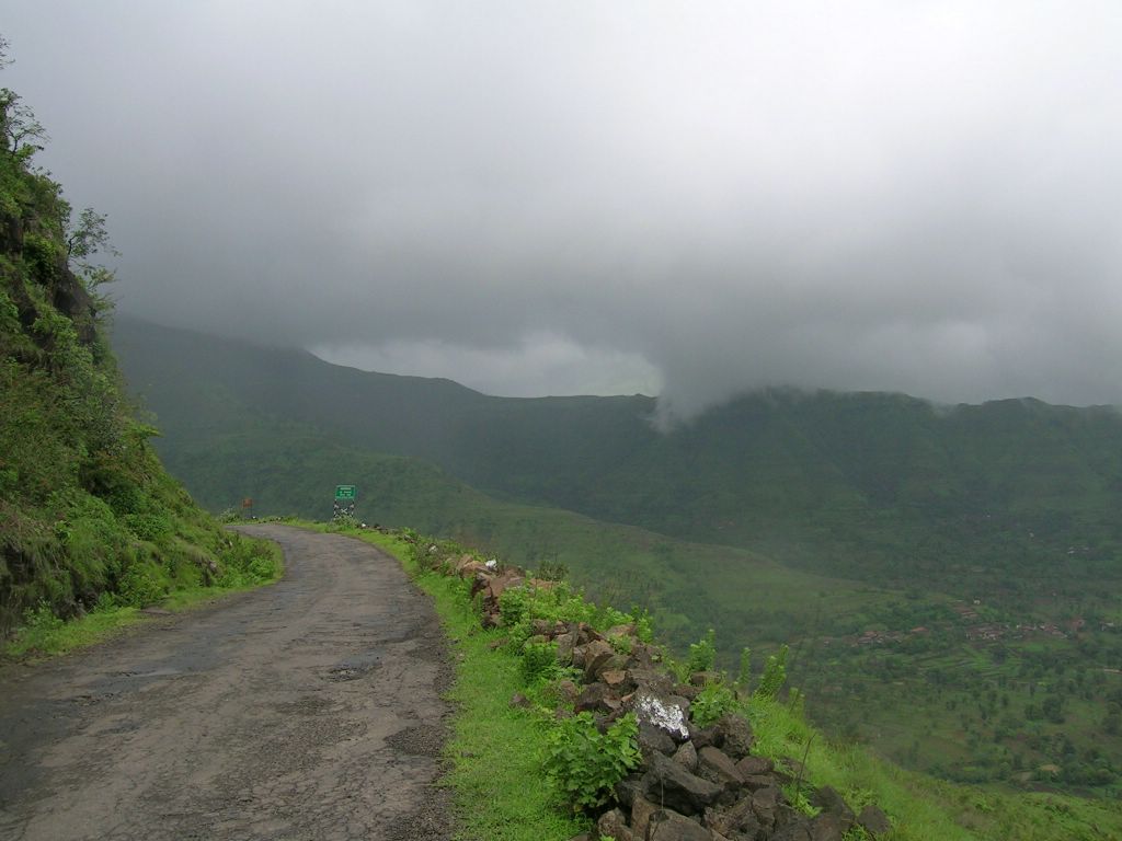
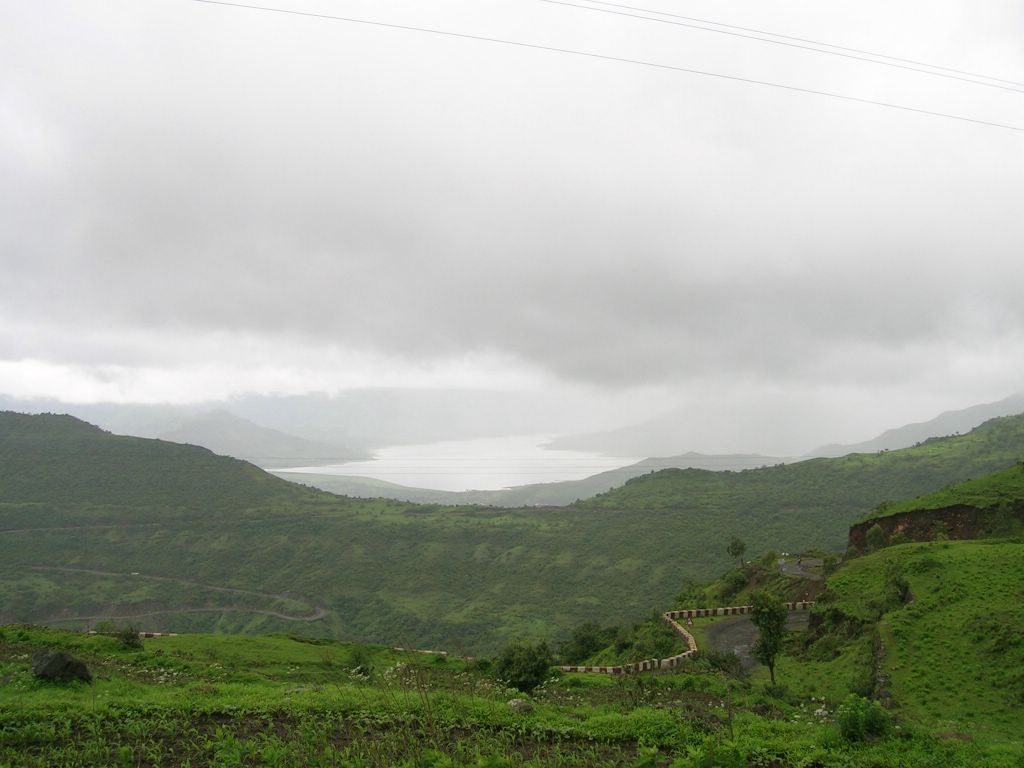
So anyways from the top of the ghat, the descend to Wai starts, this section is called as Mandhardev ghat. From here you can see the Dhom dam to right, town of Wai to the left and Pandavgad right ahead. To reach Pandavgad one can either go to Wai and then reach Menavali and start climbing.
Another route is as you are getting down Mandhardev just as the ghat ends, there is a place called Gundewadi, you can climb from here as well.
We chose the second option and it is the best option. The climb from this side takes less time. From Menavali side you have to go round the fort and join the same road to top. Menavali and Wai have lot many interesting places to visit. Menavali was the home base of the famous Peshwa minister Nana Phadanavis. His residence [ wada ] there is worth a visit.
From the top you can see table land and Pachgani ahead. Wai to left, Dhom / Kamalgad / Kenjalgad to right. Words fail me to describe the view one gets from here.
Another interesting development :
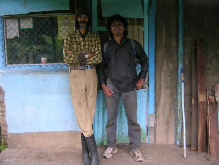
As we were returning one guy just popped out from somewhere. He said he was the watchman here and the landlord wanted to see us. So that was our encounter with Mr. Sher Wadia. This gentleman stays alone on this fort for past 22 years. There are lot of things we got to know from this gentleman. He bought the fort in an auction from Satara bank in 1983 for Rs. 40000. Now his friend owns it.
Edit: Found some info about this chap here and here.
Ajinkyatara / Pratapgad / Raigad and Pandavgad are all private properties owned by few royal families or auctioned like this one. He told us that Kamalgad in records called Kattalgad. Kamalgad was was used by the british to execute prisoners of war.
He told us that he tracked the history of fort in documents but they were all in Modi [script] and he hired a guy to interpret that and all he could go back to was 1892. He talked about his encounters with tigers [ one with stripes] etc. Offered us some coffee. If one wants to stay overnight one would have to write to Mr Vora at Mapro and seek his permission.
I have a lot to write here but then lengthy reads are boring. You can check out the pictures, they are not as cool as some of my earlier ones but enough to give you an idea. More pictures can be found here.
Epilogue :
We took a longer route from Wai in hope of a better road.
My bike gave me some trouble on the way back. So had to change the engine oil [ my own diagnosis ]. It worked. My left knee is hurting for past two treks. I need to get it diagnosed.
We started a bit late for reasons I wouldn't want to explain and you would be bored to read. We reached the Nasarapur corner at about 7.35 am and had breakfast there. We took a right turn to Bhor, [12Kms from the turn]. From Bhor you can take a left to Wai [ 35Kms from there] via Ambade ghat.
So this road actually saves a lot of distance and the ghat is an interesting and scenic place. Although don't expect an expressway kind of road. It's like a typical monsoon Pune road at places.
On top of this ghat is a place called Mandhardev which has a temple of Mandhardevi. Due to one pious individual with us, we took a turn to this place from ghats [3.5Kms from here]. This ghat separates Pune and Satara districts. The Wai taluka on one side and Bhor on other. Mandhardev is most of the times in clouds and attracts lot of pilgrims on Navratri. In February 2005 there was a stampede which claimed 300 lives.
So anyways from the top of the ghat, the descend to Wai starts, this section is called as Mandhardev ghat. From here you can see the Dhom dam to right, town of Wai to the left and Pandavgad right ahead. To reach Pandavgad one can either go to Wai and then reach Menavali and start climbing.
Another route is as you are getting down Mandhardev just as the ghat ends, there is a place called Gundewadi, you can climb from here as well.
We chose the second option and it is the best option. The climb from this side takes less time. From Menavali side you have to go round the fort and join the same road to top. Menavali and Wai have lot many interesting places to visit. Menavali was the home base of the famous Peshwa minister Nana Phadanavis. His residence [ wada ] there is worth a visit.
From the top you can see table land and Pachgani ahead. Wai to left, Dhom / Kamalgad / Kenjalgad to right. Words fail me to describe the view one gets from here.

Another interesting development :
As we were returning one guy just popped out from somewhere. He said he was the watchman here and the landlord wanted to see us. So that was our encounter with Mr. Sher Wadia. This gentleman stays alone on this fort for past 22 years. There are lot of things we got to know from this gentleman. He bought the fort in an auction from Satara bank in 1983 for Rs. 40000. Now his friend owns it.
Edit: Found some info about this chap here and here.
Ajinkyatara / Pratapgad / Raigad and Pandavgad are all private properties owned by few royal families or auctioned like this one. He told us that Kamalgad in records called Kattalgad. Kamalgad was was used by the british to execute prisoners of war.
He told us that he tracked the history of fort in documents but they were all in Modi [script] and he hired a guy to interpret that and all he could go back to was 1892. He talked about his encounters with tigers [ one with stripes] etc. Offered us some coffee. If one wants to stay overnight one would have to write to Mr Vora at Mapro and seek his permission.
I have a lot to write here but then lengthy reads are boring. You can check out the pictures, they are not as cool as some of my earlier ones but enough to give you an idea. More pictures can be found here.
Epilogue :
We took a longer route from Wai in hope of a better road.
My bike gave me some trouble on the way back. So had to change the engine oil [ my own diagnosis ]. It worked. My left knee is hurting for past two treks. I need to get it diagnosed.
Sunday, July 17, 2005
Rohida A.K.A Vichitragad
Teacup trekkers struck again. So myself and AB decided to hike Rohida on Sunday. From our experiece with Kenjalgad we decided to leave a bit early. Although we left Pune at about 5.40, which also is not bad.
To reach Rohida one has to reach Bhor and take a left to Wai and stop at a place called Bajarwadi.The climb starts from this place.
It wasnt raining although the weather was pleasent. We made it to the top in about an hour.I learnt the much talked about *macro mode* stuff, which in layman's terms (mine) is called the close up shot.I managed couple of good pictures of flowers etc with this. Although insects and some weird variety of bees made life difficult for us. There is too much of defortestation on the hills in Bhor area. There are no trees at all. All you get is eucalyptus trees. In short going to this place in summers or even winters is not advisable.
There is not much on the top. On the other side one can see Bhatghar at a distance and the road to Ambavade. I am sure you can climb from that side as well, although the entrance is one so this route would prove to be lengthy and hence not advisable.
There are couple of water tanks and a temple of Rohideshwar which is in a bad shape. We defended the perimeter wall, took good amount of snaps and got down at about 1.00 in the afternoon.
We visited Baneshwar on the way back home. This place is 2.5Kms from Nasarapur, which is on your way to Torna / Rajgad [ Velhe ]. The waterfalls at this place are beautiful, the stone unlike rest of sahyadris is a limestone'ish variety. Beware of beggers here. There is a Shiva temple so this place is flocked with Junta. We chose not to step into water as it was too slippery out there. We got back in Pune at about 5.00 which considering the things we did and accounting for the beer and tandoori chicken consumed on the way back was good.
I am pretty happy about the pictures I got, partly due to it was only two of us. So I could concentrate more on pictures of my types. Find the complete imagestation abum here.
To reach Rohida one has to reach Bhor and take a left to Wai and stop at a place called Bajarwadi.The climb starts from this place.
It wasnt raining although the weather was pleasent. We made it to the top in about an hour.I learnt the much talked about *macro mode* stuff, which in layman's terms (mine) is called the close up shot.I managed couple of good pictures of flowers etc with this. Although insects and some weird variety of bees made life difficult for us. There is too much of defortestation on the hills in Bhor area. There are no trees at all. All you get is eucalyptus trees. In short going to this place in summers or even winters is not advisable.
There is not much on the top. On the other side one can see Bhatghar at a distance and the road to Ambavade. I am sure you can climb from that side as well, although the entrance is one so this route would prove to be lengthy and hence not advisable.
There are couple of water tanks and a temple of Rohideshwar which is in a bad shape. We defended the perimeter wall, took good amount of snaps and got down at about 1.00 in the afternoon.
We visited Baneshwar on the way back home. This place is 2.5Kms from Nasarapur, which is on your way to Torna / Rajgad [ Velhe ]. The waterfalls at this place are beautiful, the stone unlike rest of sahyadris is a limestone'ish variety. Beware of beggers here. There is a Shiva temple so this place is flocked with Junta. We chose not to step into water as it was too slippery out there. We got back in Pune at about 5.00 which considering the things we did and accounting for the beer and tandoori chicken consumed on the way back was good.
I am pretty happy about the pictures I got, partly due to it was only two of us. So I could concentrate more on pictures of my types. Find the complete imagestation abum here.
Sunday, July 10, 2005
Chavand A.K.A Prasannagad
Myself and the Paxonet guys hiked Chavand this weekend. I had made plans to go to this place last week itself, although it did not work out. We were about a team of eight and started in a Sumo from the *usual place*.
To reach this place take the road from Junnar to Ghatghar (Jeevdhan / Naneghat). Some 17Kms from Junnar lies the fort of Chavand.
The consturction is all in ruins although you can clearly tell it wasnt built by Marathas. History says it was fort built by the Satvahanas.
Myself P and L seperated from the group and decided to defend the perimeter wall. It took us quite some time to go round the hillock in the middle of the fort. The ladder on the way up is interesting and had it not been there, although you cant trust that. I wouldnt want to climb the fort. The view from top is breathtaking. You can see the Kukadi - Manikdoh dam waters everywhere. We were told the backwaters almost reach Ghatghar in heavy rains. One can see fort of Hadsar on the oppositte side of the Manikdoh dam.
You can also spot Jeevdhan and Naneghat to the left.
We attempted to go to Naneghat but the road conditions prompted us to head back. I couldnt get much good pictures due to poor light. Check out the imagestation album here.
To reach this place take the road from Junnar to Ghatghar (Jeevdhan / Naneghat). Some 17Kms from Junnar lies the fort of Chavand.
The consturction is all in ruins although you can clearly tell it wasnt built by Marathas. History says it was fort built by the Satvahanas.
Myself P and L seperated from the group and decided to defend the perimeter wall. It took us quite some time to go round the hillock in the middle of the fort. The ladder on the way up is interesting and had it not been there, although you cant trust that. I wouldnt want to climb the fort. The view from top is breathtaking. You can see the Kukadi - Manikdoh dam waters everywhere. We were told the backwaters almost reach Ghatghar in heavy rains. One can see fort of Hadsar on the oppositte side of the Manikdoh dam.
You can also spot Jeevdhan and Naneghat to the left.
We attempted to go to Naneghat but the road conditions prompted us to head back. I couldnt get much good pictures due to poor light. Check out the imagestation album here.
Tuesday, June 28, 2005
Monday, June 27, 2005
Kenjalgad A.K.A Ghera Khelanja
I cooked a plan with AB for a Sunday Kenjalgad bike adventure on Friday. I couldnt get much response from the paxonet teacup trekkers and that was expected. We started off early in the morning at 6.00 on a pleasant Sunday morning. Had breakfast on the tapri located at the Bhor corner.
To reach Kenjalgad one has to pass Bhor and take the road to Ambavade. From Ambavade take a right from the bridge and proceed towards Jambhulwadi / Korle. This stretch of road demands skills and is a remenant of tarmac road which must have existed in Shivaji's era. We parked our bike at the village before Jambhulwadi / Korle and took a walk as the road got nastier.
We started our climb at 9.00 in the morning, despite of being advised by the local guys we took the Raireshwar road which goes up till the summit and you take a left to Kenjalgad. This proved disastrous, we reached the extreme right side of the massif and couldnt find the way up. Going across to the left side was a bit tedious but we could manage it.
Other motivation behind this was the need for a *safe passage* on the way back.
There is not much to see on the fort. One can see the Wai side from the top and the backwaters of Dhom dam. One can see Kamalgad and Navra-Navri of Kamalgad on the other side of Walki river from the top. There was too much of rain and too much of wind, although I managed a couple of snaps.
The journey back was far from exciting, It was raining heavier in Pune. I had some serious problem with my bike in Katraj and it continued till I reached home and it still is with me.
I spoiled my cellphone on this trek and I hope the camera is about to dry as I reach home. Ill post the pictures if the thing is intact. Check out the complete imagestation album here.
To reach Kenjalgad one has to pass Bhor and take the road to Ambavade. From Ambavade take a right from the bridge and proceed towards Jambhulwadi / Korle. This stretch of road demands skills and is a remenant of tarmac road which must have existed in Shivaji's era. We parked our bike at the village before Jambhulwadi / Korle and took a walk as the road got nastier.
We started our climb at 9.00 in the morning, despite of being advised by the local guys we took the Raireshwar road which goes up till the summit and you take a left to Kenjalgad. This proved disastrous, we reached the extreme right side of the massif and couldnt find the way up. Going across to the left side was a bit tedious but we could manage it.
Other motivation behind this was the need for a *safe passage* on the way back.
There is not much to see on the fort. One can see the Wai side from the top and the backwaters of Dhom dam. One can see Kamalgad and Navra-Navri of Kamalgad on the other side of Walki river from the top. There was too much of rain and too much of wind, although I managed a couple of snaps.
The journey back was far from exciting, It was raining heavier in Pune. I had some serious problem with my bike in Katraj and it continued till I reached home and it still is with me.
I spoiled my cellphone on this trek and I hope the camera is about to dry as I reach home. Ill post the pictures if the thing is intact. Check out the complete imagestation album here.
Subscribe to:
Posts (Atom)